Segments
 Farming Companies
 Seed Production Companies
 Agri Input Companies
 Financial Lending Institutions
 Crop Insurance Provider
 Government & Advisories
 Farming Companies
MAXIMIZING VALUE.
PER ACRE.

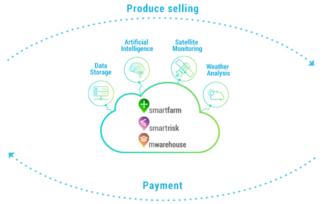

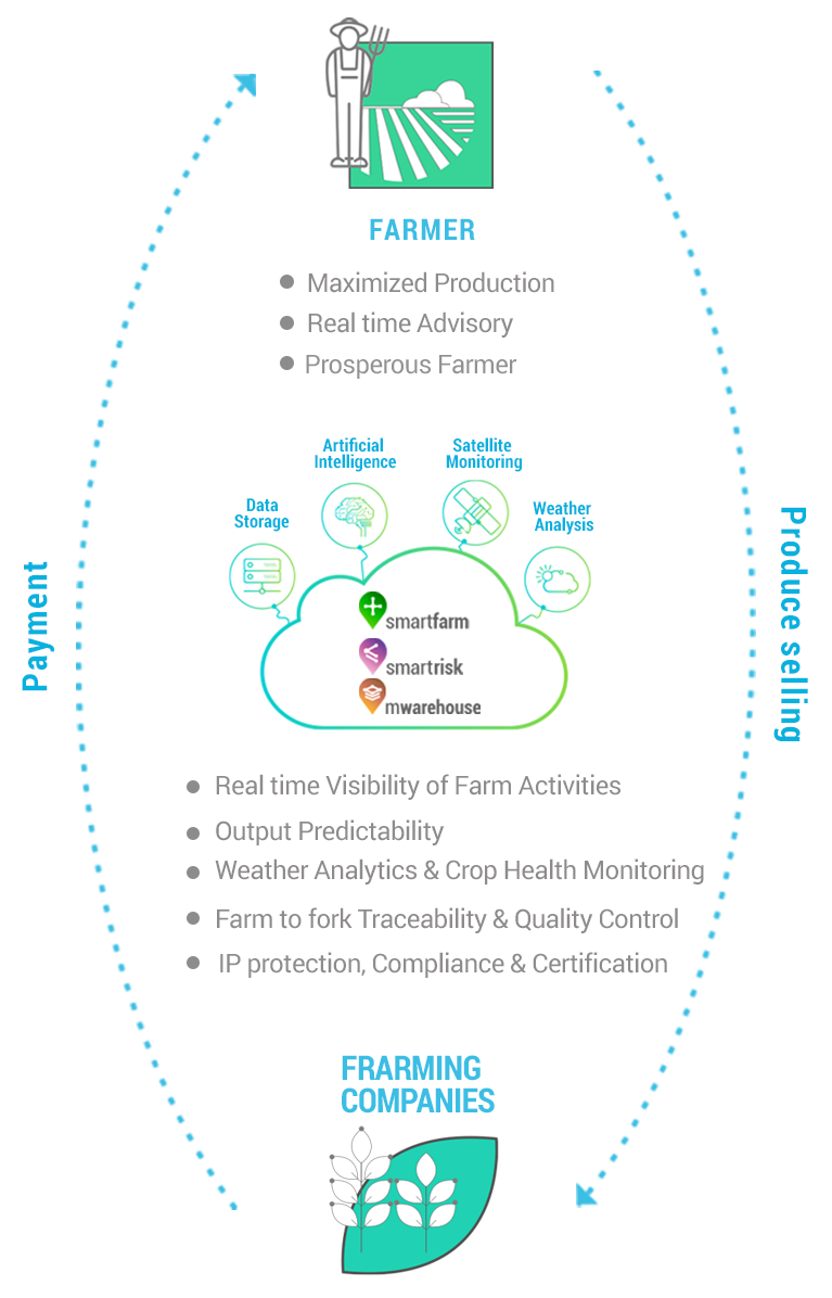
FARMER
- Maximized Production
- Real time Advisory
- Prosperous Farmer
FARMING
COMPANIES
- Real time Visibility of Farm Activities
- Output Predictability
- Weather Analytics & Crop Health Monitoring
- Farm to fork Traceability & Quality Control
- IP protection, Compliance & Certification
 Challenge
Farming companies are burdened by limited traceability and operational visibility along the crop cycle. The information asymmetry across the supply chain damages their output predictability as they work towards overcoming the challenges of ineffective collaboration. Traceability and operational visibility along the crop cycle is a challenge for farm management companies.
 Utility
Track-and-trace tools offer quantitative and qualitative analysis of your produce from sowing till selling, for better predictability.
Field Archive
Field files are archived all in one place, readable from any mobile device or desktop computer, with a detailed recording for each plot along with photos, crop type, acreage and sowing information.
Crop Stage Management
Satellite based geo-tagging of plots ensures accurate prediction, with real-time updates to track the various stages of the crop. Get visual confirmation, timely alerts and customized analysis on how crops performed by zone, input, and more.
Remote Activity Monitoring
Track, trace and accomplish all your daily tasks and schedules with precision. Field staff based tracking ensures that all supervisors follow the best practices on time.
Yield Health Advisory
Access customized plot-based advisory modules for pest and disease resolution from a central location, along with real time harvest forecasts and estimations, to help optimize supply chain and reduce losses.
Micro to Macro Optimization
Weather advisory, remote sensing, insights strengthened by machine learning and artificial intelligence adjust harvest rates to soil productivity and past field performance, so that you can avert overspending on inputs while realizing your optimal yield.
 Seed Production Companies
MAXIMIZING QUALITY.
PER ACRE.

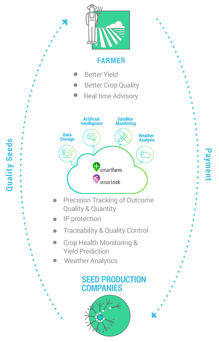
FARMER
- Better Yield
- Better Crop Quality
- Real time Advisory
SEED PRODUCTION COMPANIES
- Precision Tracking of Outcome Quality & Quantity
- IP protection
- Traceability & Quality Control
- Crop Health Monitoring & Yield Prediction
- Weather Analytics
 Challenge
Seed production organizations face hurdles of quality management, data collection, audit and monitoring, while lack of precision tracking results in poor output predictability and ineffective management.
 Utility
Track-and-trace tools offer quantitative and qualitative analysis of your produce from sowing till selling, to better predictability.
Field Archive
Field files are archived all in one place, readable from any mobile device or desktop computer , with a detailed recording for each plot along with photos, crop type, acreage and sowing information.
Crop Stage Management
Satellite based geo-tagging of plots ensures accurate prediction, with real-time updates to track the various stages of the crop. Get visual confirmation, timely alerts and customized analysis on how crops performed by zone, input, and more.
Remote Activity Monitoring
Track, trace and accomplish all your daily tasks and schedules with precision. Field staff based tracking ensures that all supervisors follow the best practices on time.
Yield Health Advisory
Access customized plot-based advisory modules for pest and disease resolution from a central location, along with real time harvest forecasts and estimations, to help optimize supply chain and reduce losses.
Micro to Macro Optimization
Weather advisory, remote sensing, insights strengthened by machine learning and artificial intelligence adjust harvest rates to soil productivity and past field performance, so that you can avert overspending on inputs while realizing your optimal yield.
 Agri Input Companies
MAXIMIZING SALES EFFICIENCY.
PER ACRE.

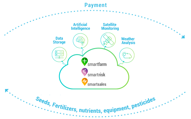

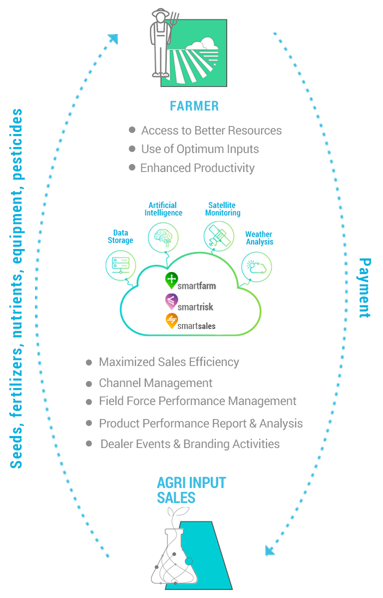
FARMER
- Access to Better Resources
- Use of Optimum Inputs
- Enhanced Productivity
AGRI INPUT
SALES
- Maximized Sales Efficiency
- Channel Management
- Field Force Performance Management
- Product Performance Report & Analysis
- Dealer Events & Branding Activities
 Challenge
Fertilizer, Seed Sales, Crop Protection, Nutrients, Farm Machinery companies constantly grapple with low visibility on marketing initiatives, inefficient operations and field force management, as well as lack of a centralized database of farmers’ information.
 Utility
CropIn offers systematic tools for your sales teams to get an edge over competition.
Field Archive
Field files are archived all in one place, readable from any mobile device or desktop computer ,with a detailed recording for each plot along with photos, crop type, acreage and sowing information.
Campaign Management
A customized Marketing and Communications dashboard offers visibility of demos and effectiveness in terms of lead generation and farmer reach. Easy to use event modules help you create events, register farmers and track attendance.
Demand Projection
Demand generation and demand forecast of inputs to newly registered farmers helps you track demand and fulfillment. This empowers you to make field decisions based on what will contribute to your bottom line.
Inventory Module
Effectively manage your inventory though satellite tracking between locations basis demand prediction.
Task Assist
A centralized dashboard helps you track, view and report field force performance in terms of events conducted, orders generated, leads generated and orders fulfilled.
 Financial Lending Institutions
MAXIMIZING RETURNS/RELIABILTY.
PER ACRE.


FARMER
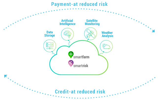
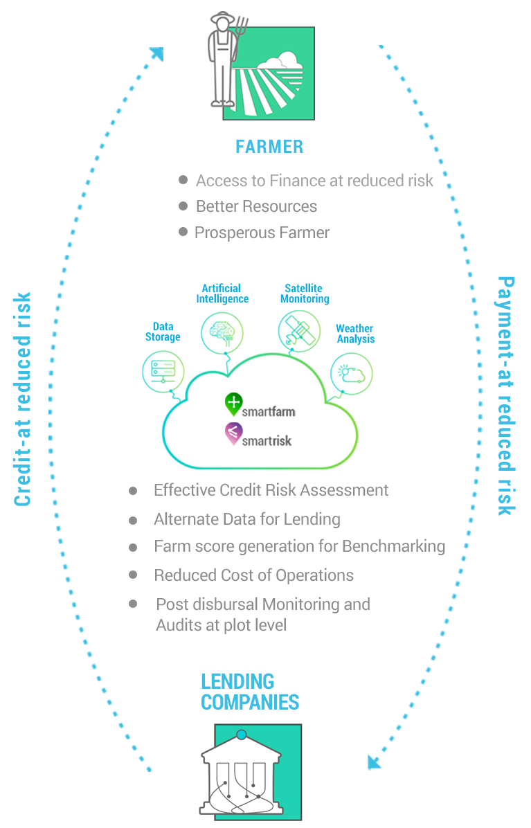
- Access to Finance at reduced risk
- Better Resources
- Prosperous Farmer
LENDING
COMPANIES
- Effective Credit Risk Assessment
- Alternate Data for Lending
- Farm score generation for Benchmarking
- Reduced Cost of Operations
- Post disbursal Monitoring and Audits at plot level
 Challenge
- Credit Risk Assessment due to lack of historical performance and risk profile
- Information Asymmetry due to lack of alternate data source
- High Cost of Operations as the lending personnel have to physically check on every farmer loan
 Utility
CropIn provides Agri Alternate Data for quick and accurate decision-making.
Effective Credit Risk Assessment through Agri Alternate data
Weather Risk Prediction, Plot Benchmarking using historical analysis and Yield Prediction using satellite imagery enable effective risk assessment.
Plot Based Monitoring System
Proprietary machine learning algorithm built on satellite and weather data is used to give insights at plot level.
Loan Utilization
Access real-time crop sowing & performance details, and track harvest cycles so that you can follow up on payments based on plot performance.
Operational Efficiency
Reduced cost of operations through one step farmer KYC, pre-disbursal evaluation & post disbursal monitoring and audits.
 Crop Insurance Provider
MAXIMIZING RETURNS/RELIABILTY.
.
PER ACRE.


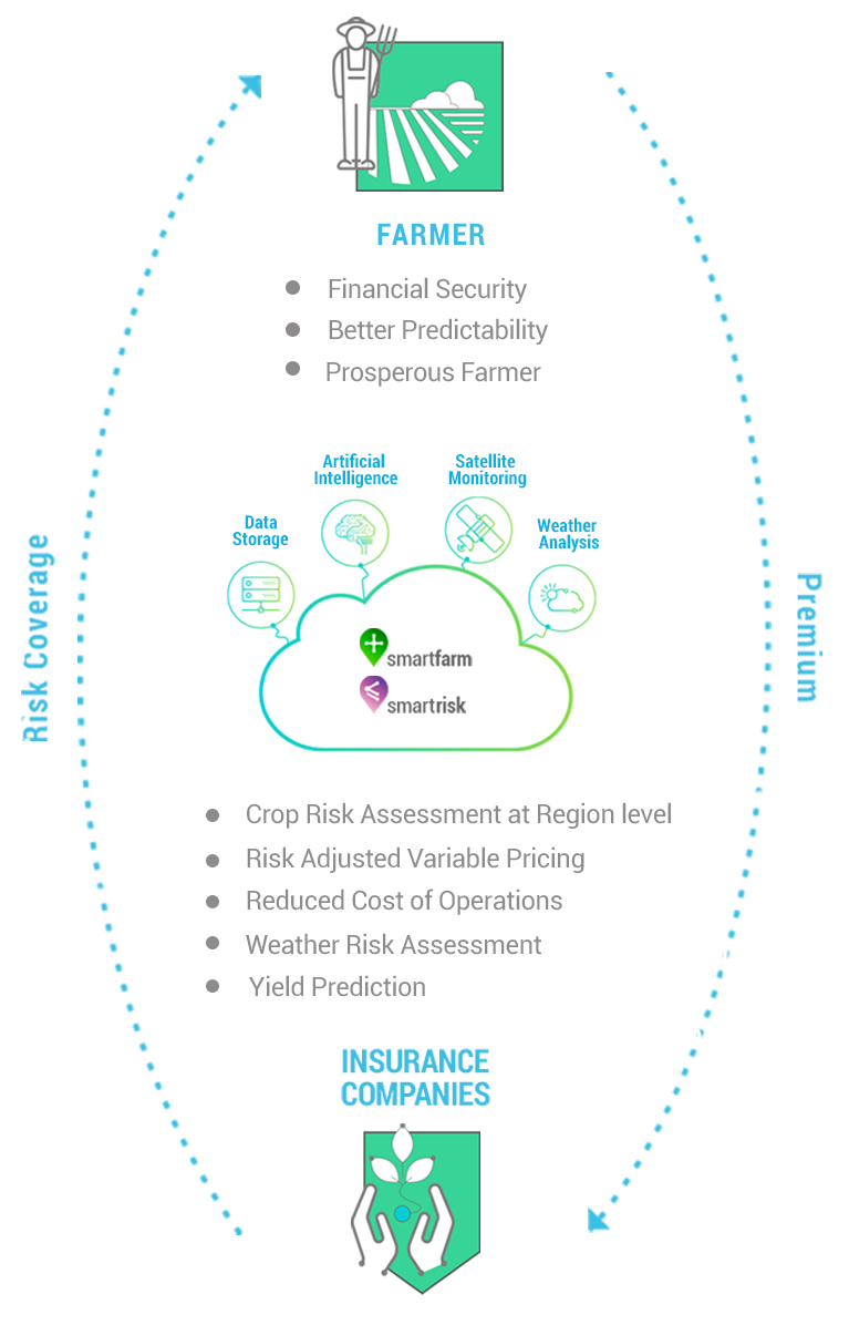
FARMER
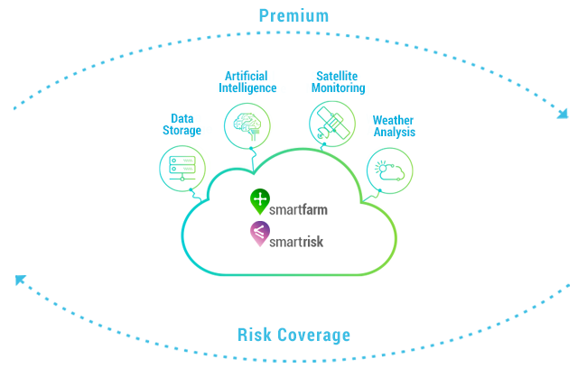
- Financial Security
- Better Predictability
- Prosperous Farmer
INSURANCE
COMPANIES
- Crop Risk Assessment at Region level
- Risk Adjusted Variable Pricing
- Reduced Cost of Operations
- Weather Risk Assessment
- Yield Prediction
 Challenge
- Effective Risk Assessment due to lack of historical performance and risk profile
- Information Asymmetry due to lack of alternate data source
- Inefficient Operations as the personnel have to travel back and forth for farmer KYC
 Utility
CropIn provides Agri Alternate Data that helps crop insurance providers in quick and accurate decision-making.
Effective Region level/Plot level Crop Risk Assessment
Proprietary machine learning algorithm built on satellite and weather data is used to give insights at regional level.
Risk Adjusted Variable Pricing
Weather Risk Prediction, Region level Benchmarking using historical analysis and Yield Prediction using satellite imagery ensure risk adjusted variable pricing.
Operational Efficiency
Reduced cost of operations through one step farmer KYC.
 Government & Advisories
MAXIMIZING IMPACT.
.
PER ACRE.


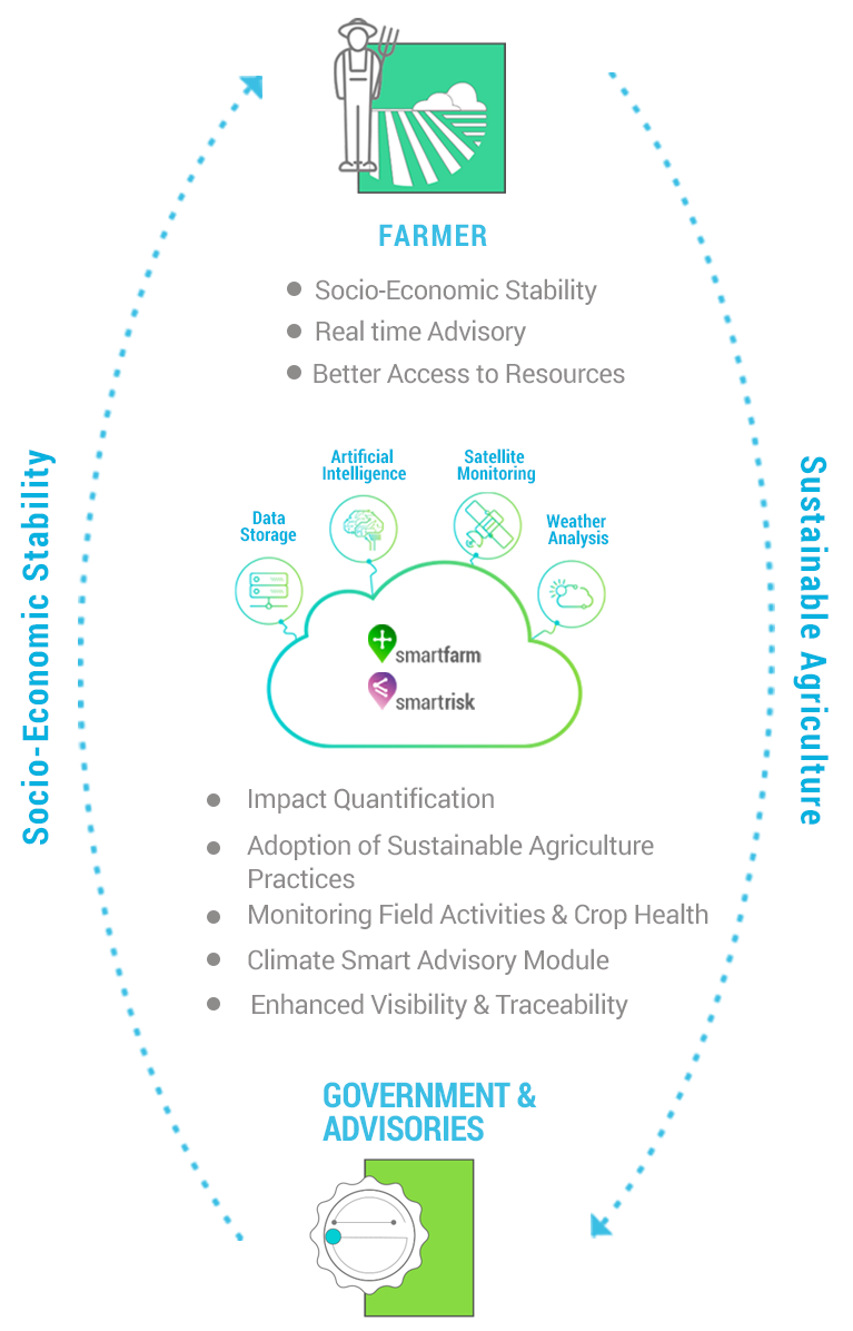
FARMER
- Socio-Economic Stability
- Real time Advisory
- Better Access to Resources
GOVERNMENT &
ADVISORIES
- Impact Quantification
- Adoption of Sustainable Agriculture Practices
- Monitoring Field Activities & Crop Health
- Climate Smart Advisory Module
- Enhanced Visibility & Traceability
 Challenge
To provide enhanced visibility to organizations and ensure sustainability and consistency of food-feed-fibre.
 Utility
CropIn’s proprietary tools help increase food security, by powering productivity with data-driven analytics.
Farmer Outreach
Impact more and more farmers through a systematic and archived database – with customized field files for each farmer.
Campaign Management
A customized dashboard that offers visibility of demos and effectiveness in terms of farmer reach ensuring better marketability for the farmers to earn more, by engaging them in marketing and communication campaigns.
Harvest Health Advisory
A centralized yet customized plot-based advisory module for pest and disease resolution, best agriculture practices, input application and crop planning.
Training Support
Easy to use training modules for field team agents enable them to conduct workshops and programs to provide awareness to farmers and organize themselves with efficiency.
Algorithm of Change
Create a transformational social impact by empowering farmer or grower through technology that trains them to utilize their avenues; with an easy-to-adopt system that effortlessly fits into their daily routine.
Clients






INVESTORS



PARTNERS




Footer
Contact
- Address:
- 1309 S. 240th St, Suite 325
Elkhorn, NE 68022
- Phone:
- 888-355-5420
- Email:
- info@agnetwork.com
